Celestial Navigation in the Golden Age of Piracy
The Northern Hemisphere
of the planet Earth has a very special star. Polaris, also known as the North
Star, sits almost exactly over the axis point of Earth’s rotation. Anyone,
looking into a clear night sky, can determine the direction North – no matter
what the season, no matter what the time of night.

One ancient name for
Polaris was Cynosūra, from the Greek word meaning "the dog’s tail"
(reflecting a time when the constellation of Ursa Minor "Little Bear"
was taken to represent a dog), hence the English word cynosure. Most other
names are directly tied to its role as pole star.
In English, it was
known as "pole star" or "north star"; in Spenser, also
"steadfast star".

An older English name,
attested since the 14th century, is lodestar "guiding star", similar
in meaning to the old German and Old Norse names.
The name Polaris in
English goes back to the 17th century (just before the pirates; time). It is a contraction
for the Latin stella polaris "pole star". Another Latin name is
stella maris "sea-star" denoting its importance to sailors. Stella Maris was also used as a title of the
Blessed Virgin Mary, popularized in the hymn Ave Maris Stella –from the 8th
century.

Navigation by the stars
– celestial navigation – is believed to have started in the trackless
wilderness of Earth’s deserts, and was almost immediately adopted by fledgling
mariners.
The sea is a
treacherous place to travel. Not only are there no landmarks (land-marks) but
the water is constantly moving – often not going the direction that a sailor
wants to go. Sailing against a strong current could – and in the early days of
sail, actually did – mean a ship was actually traveling backwards. Add to this
that the wind rarely blew in the direction a ship needed in order to sail, and it’s
easy to see why navigation was a tricky matter at best.
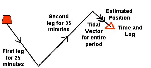
Without instruments, it’s
possible to figure an approximate location at sea by using ded reckoning. This was done with a peg-board, marking the
approximate forward motion, the amount of drift, and the direction of travel,
including changes of direction made during the day.
This method allowed an approximate
location to be determined. But it was a matter of instinct as much as intelligence.
Many of the calculations involved in ded reckoning were felt as much as known.

Celestial navigation
involved MATH, and it involved instruments. During the Golden Age of Piracy,
only latitude (the distance from the North Pole, shown on globes as a series of
rings, the most recognizable of which is the Equator) could be accurately
determined at sea. In order to find a given point, such as an island, the navigator
tried to put the ship on track along a given longitude, then “run down the line”
until the desired location was achieved.
During
the Golden Age, the most advanced instrument in common use was the Davis Quadrant.
The device used to measure – in degrees – the distance from the horizon of a
celestial body. If, for instance, Polaris is ten degrees from the horizon, he
is about ten degrees north of the equator.

The
method requires that a couple of conditions be met. For one thing, it requires
a clear view of both the North Star and the horizon. It also requires that the
navigator be somewhere north of the equator. On the southern side of the
equator, Polaris is not visible, and there is no southern pole star.
The
other method of celestial navigation uses the sun. If the exact position of the
sun is calculated, relevant to the horizon, at exactly noon, the angle by which
the sun’s position deviates from 90 degrees can be used to reveal the latitude.
Using the right equipment, it’s a slightly more accurate measurement – and accuracy
is important, especially when you’re all alone on the deep blue sea, looking for
land.

Eventually,
the invention of the sextant made latitude calculation even more exact. Longitude
can be measured in the same way. If one can accurately measure the angle to
Polaris, a similar measurement to a star near the eastern or western horizons
will provide the longitude. The problem is that the Earth turns 15 degrees per
hour, so these measurements depend on time. A measure a few minutes before or
after the same measure the day before creates serious navigation errors. The
invention of the modern chronometer by John Harrison in 1761 vastly simplified
longitudinal calculation.
Of
course, modern navigation relies not on the stars, but on GPS positioning. Satellites
in geo-stable orbits over the earth’s surface send signals that can be used to
determine the exact position of a ship at sea or a car whose driver wants to
find the nearest Burger King. Technology
has enabled navigation so precise that for a time, celestial navigation was no
longer taught by the US Navy.
But
navigation by the stars is making a come-back. The computers may break down,
the satellites may even be shot down, but the stars will always be with us. The
stars can be our guides until the end of time.
Heaven
Bless all my readers, Happy Winter Solstice, and a Merry Christmas.

I must say that the articles in this blog are very interesting to read. The second one, I must say this blog loads a lot quicker then most. Penis envy mushrooms
ReplyDeleteSuch a very useful article
ReplyDeleteAn extremely good post.
ReplyDeleteData are very well written
ReplyDeleteWhat's up, na het lezen van dit geweldige bericht ben ik ook blij
ReplyDeleteom mijn kennis hier met vrienden te delen.
ReplyDeleteGreat! It sounds good. Thanks for sharing
I encourage you to read this text it is fun described ...
ReplyDeleteNice post! Check Dentist in Milpitas for Restorative, General, Technology, Emergency, and Invisalign.
ReplyDeleteGreat insights! Explore services: Trademark, Patent, Design, Copyright, Private, Partnership, OPC today now.
ReplyDeleteGreat blog, explore Company registration, Private, Trademark, Copyright, Patent, LLP, OPC services in Chennai for business growth and legal support today
ReplyDelete
ReplyDeleteThank you for the good story. Considered a great and very useful content
ReplyDeleteThis is the perfect website for anyone who really wants to understand this topic.
ReplyDeleteI every time spent my half an hour to read this blog’s
ReplyDeleteI like the valuable information you supply for your articles
ReplyDeleteNice Blog. Thanks for sharing with us. Such amazing information.